How to use Google Maps on your phone or tablet in Street View
Google Maps is an indispensable tool that can help you out in an unfamiliar place and help you find the things you need nearby. With this application on your phone, you will not only no longer ask passers-by for directions, but also get a number of useful tools for the game, such as street view, distance and area measurement.
Street View has long been a feature of Google Maps and allows us to take virtual tours of cities and roads in many parts of the world. This feature is easy to use and can play a very important role in planning your trips. If you have never used it, check if this feature is available in your country or locality.
How to turn on Street View on your smartphone or tablet
Make sure you have the Google Maps app installed on your Android or iOS device. If not, install it.
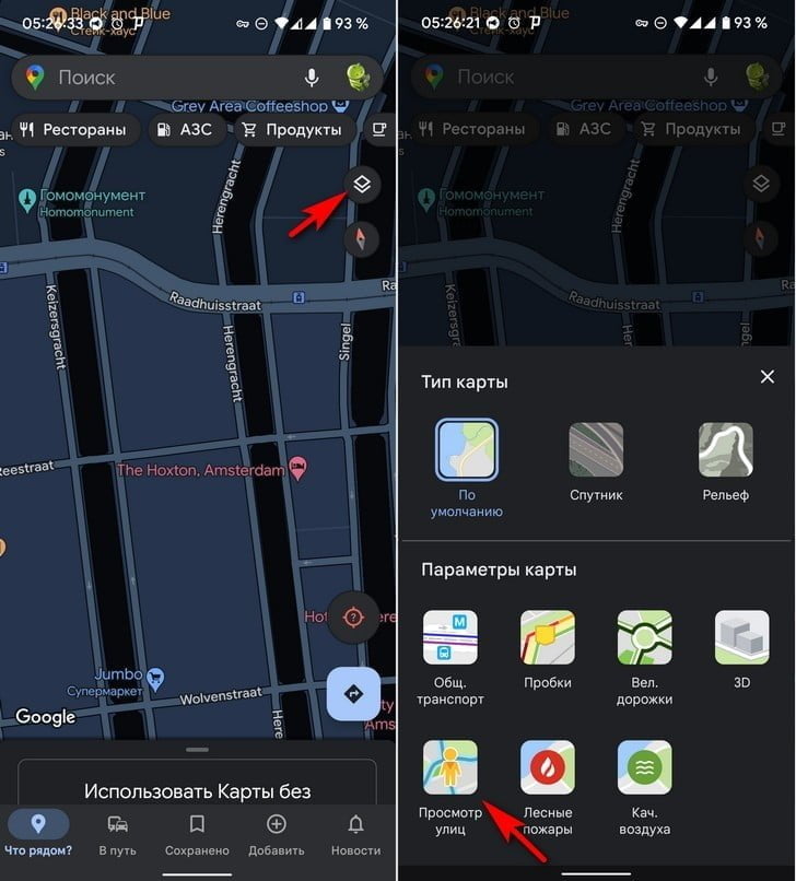
1. Open the Google Maps app and look for the “Layers” icon in the top right corner of the display (marked in the image below).
2. Select Street View from the menu that opens.
3. Press the X button or anywhere outside of the Layers menu to return to the map.

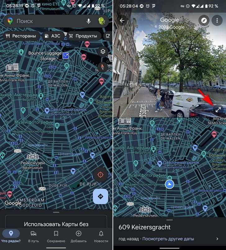
If Street View is available in the region you are viewing, then the corresponding roads, sidewalks and trails and roads will be marked with a blue line.
4. Touch any place you want to explore and the app will go into split screen mode. The top half will show street view and the bottom half will show the default map view in case you want to navigate to another location.
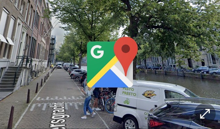
5. Tap the “Maximize” icon in the lower right corner of the “Street View” window to enter full screen mode in this mode.

To move, tap the direction arrows or double-tap the direction you want to move. You can also zoom in for a closer look.
